This archive is retained to ensure existing URLs remain functional. It will not contain any emails sent to this mailing list after July 1, 2024. For all messages, including those sent before and after this date, please visit the new location of the archive at https://mailman.ripe.net/archives/list/ripe-atlas@ripe.net/
[atlas] probe coverage map?
- Previous message (by thread): [atlas] evaluating ripe atlas
- Next message (by thread): [atlas] probe coverage map?
Messages sorted by: [ date ] [ thread ] [ subject ] [ author ]
Bajpai, Vaibhav
v.bajpai at jacobs-university.de
Wed May 18 15:07:25 CEST 2016
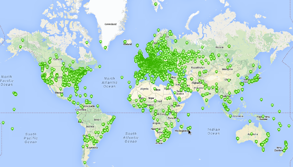
Hello,

What happened to the probe coverage map that showed number of probes
at different level of details depending on the zoomed-in state of
the map? — I have an earlier screenshot [a] (2015) to explain what
I mean. It was a very nice plot.

[a] http://i.imgur.com/d0tI1qP.png

I was looking for a probe coverage map to put in one of my slides.
I ended up using [b], but I miss [a].

[b] https://www-static.ripe.net/static/rnd-ui/atlas/static/page/img/allprobes.png

Best, Vaibhav

===================================
Vaibhav Bajpai
www.vaibhavbajpai.com

Room 91, Research I
School of Engineering and Sciences
Jacobs University Bremen, Germany
===================================
-------------- next part --------------
A non-text attachment was scrubbed...
Name: signature.asc
Type: application/pgp-signature
Size: 496 bytes
Desc: Message signed with OpenPGP using GPGMail
URL: </ripe/mail/archives/ripe-atlas/attachments/20160518/0b710d5a/attachment.sig>
- Previous message (by thread): [atlas] evaluating ripe atlas
- Next message (by thread): [atlas] probe coverage map?
Messages sorted by: [ date ] [ thread ] [ subject ] [ author ]